Praia da Marinha (Lagoa)
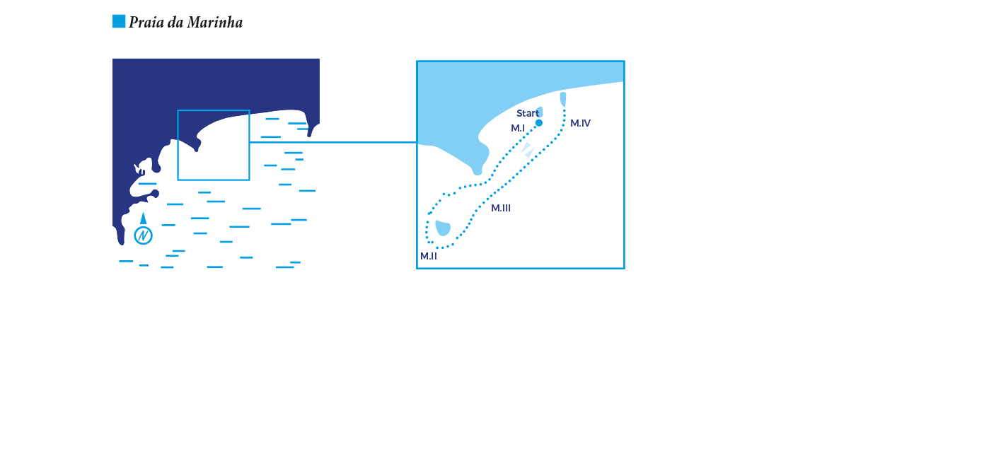
This section describes one of the three routes that were created for the beach “Praia da Marinha”, in Lagoa. The four zones of the route are described with specific interpretative slates. The path starts near the rocky outcrop which delimits the beach on the West side.
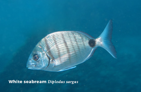
This area is characterized by a sandy bottom with small rocks (zone M.I). Several species of juvenile seabreams (e.g. Diplodus sargus) populate the area and in the rocky wall, barnacles (Chthamalus spp. and Balanus sp.) can be observed (average depth of 1-2m).
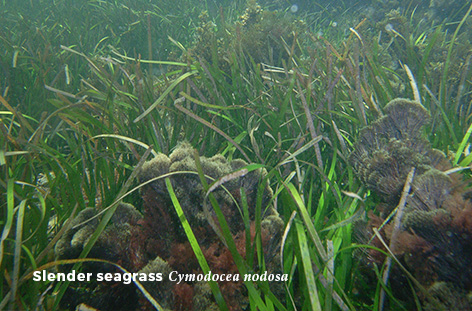
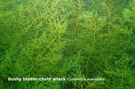
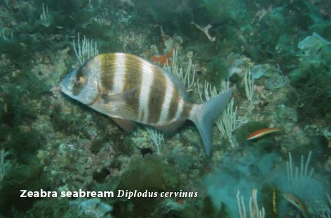
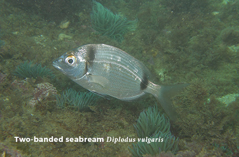
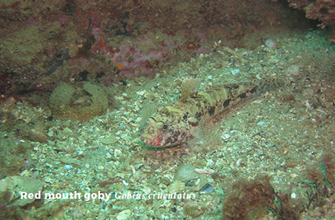
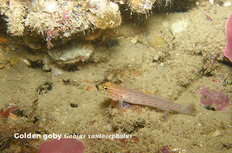
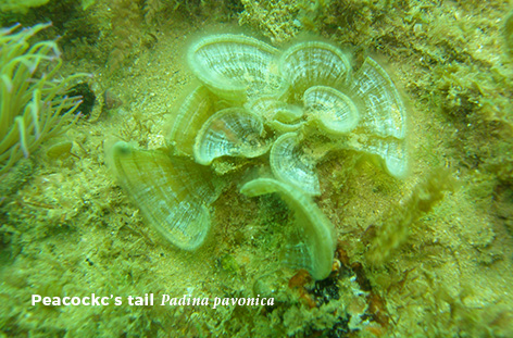
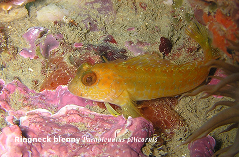
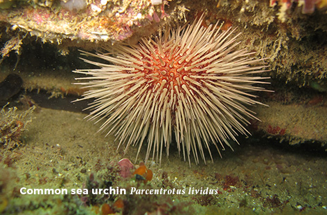
The diver must continue swimming away from the beach, until reaching the small island located beyond the end of the rocky wall. Along this route the bottom is mainly composed by flat sheets of rock, with high algae cover (e.g. Cystoseira usneoides), sea anemones, sea urchins and some sea cucumbers. In the middle of this area, a small seagrass meadow of (Cymodocea nodosa) can be explored (average depth of 3.3m). It must be emphasized that these meadows (although small in size) are quite rare outside the coast of the Mediterranean Sea. Common two-banded seabreams (Diplodus vulgaris), zebra seabreams (Diplodus cervinus),gobies and blennies (e.g. Gobius cruentatus, Gobius xanthocephalus, Parablennius pilicornis)can be frequently observed in this habitat.
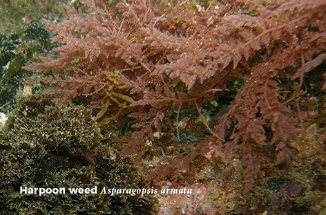
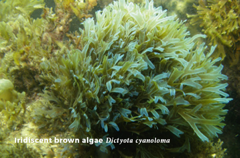
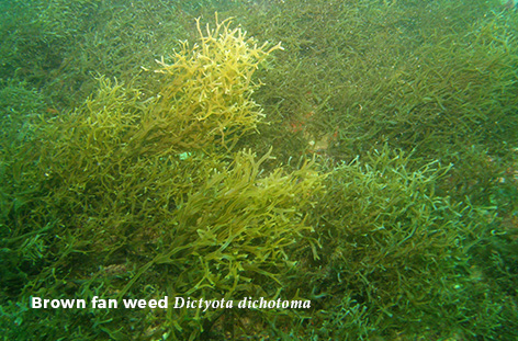
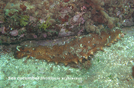
The visitor should now go around the small islet that emerges in this area in an anti-clockwise direction (average depth of 3m) (zone M.II). With high biodiversity, this area is frequently inhabited by Caneva’s blenny (Lipophrys canevae), seabreams, different invertebrates such as sea cucumbers (e.g. Holothuria arguinensis), and several algae species (Asparagopsis armata, Dictyota dichotoma, D. cyanoloma).
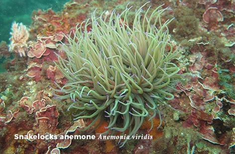
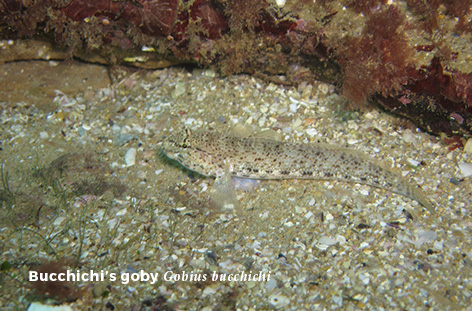
The return path should be made towards the entrance of the beach (zone M.III)to a small sandy clearing with rocky outcrops (average depth of 3m), where gobies and invertebrates (such as the anemone Anemonia viridis which are frequently associated with Gobius bucchichi) are common.
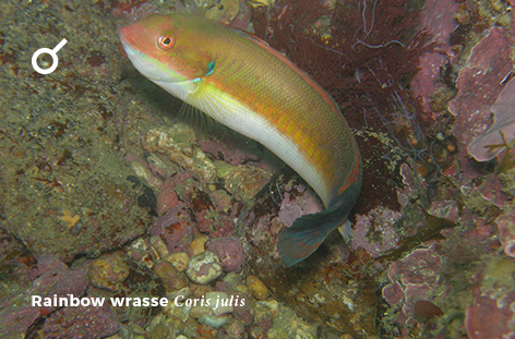
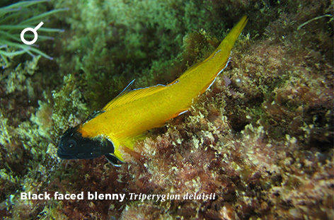
The visitor must now swim back to the beach, where the sandy bottom provides a safe exit area (zone M.IV).In this final zone some fragments of the seagrass meadow of C. nodosa,can still be explored, allowing the observation of gobies, such as the black-faced blenny (Tripterygion delaisi), and the Mediterranean rainbow wrasse (Coris julis). Before exiting the route, next to the three small rocky blocks, juveniles of seabreams, sand smelts (Atherina presbyter) and mullets (Liza spp.) can be easily spotted.
ACESSBeach |
HARBOUR DISTANCE– |
DIFFICULTYLow |
AVERAGE TIME45 min. |
MAX. DEPTH4m |
HABITATFlagstone, Sand, Rocky outcrops, Islands, Pebbles, Seagrass meadows |
LANDSCAPE INTERESTHigh |
BIOLOGICAL INTERESTHigh |
CONSERVATION
|
SNORKELING |
CERTIFICATIONGood adaptation to water |
NOTESIn the summer season an interpretative wooden placard placed in the sand will provide all the information needed for self-guidance on the route. Also, interpretative slates will be placed at the surface of the water, attached to orange buoys, to guide the divers along the route |
Conservation
This habitat requires appropriate conservation measures due to the occurrence of seagrass meadows (EU_Habitat Directive).
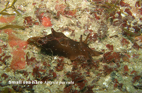
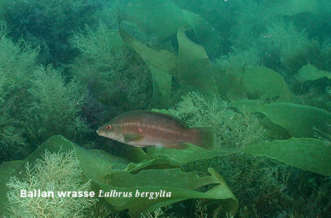
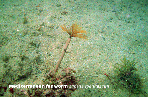
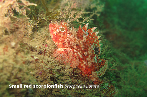
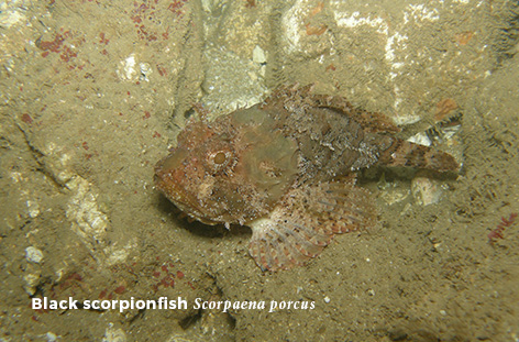
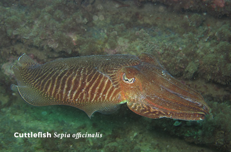
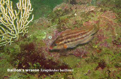
Species photos